Montreal is an island. Those of us who live on the island sometimes take this fact for granted.
Back in 2021 I took my first spin on the region’s fledgling boat service, drawing comparisons with London to make the point that waterways held unlocked transit potential. And whilst London has just the one river flowing through its core, Montreal is surrounded by water, and ergo also surrounded by that potential for other ways to get around, at least when outside of Winter.
So two summers later, how are the waterways of Québec’s metropolis faring?
Private Enterprise
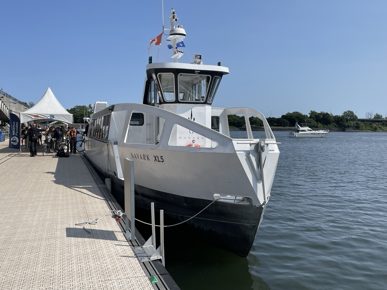
The running of Montreal’s boats has been farmed out to Navark. (Disclaimer: there may be other companies running other routes as well, but the information isn’t well centralised and seems to change from year to year). They maintained an impressive 12 routes this season, aimed at a combination of commuting and leisure.
Being an island-dweller, I don’t often have reason to take the boats, but I wanted to find an excuse to try out two of the routes anyway:
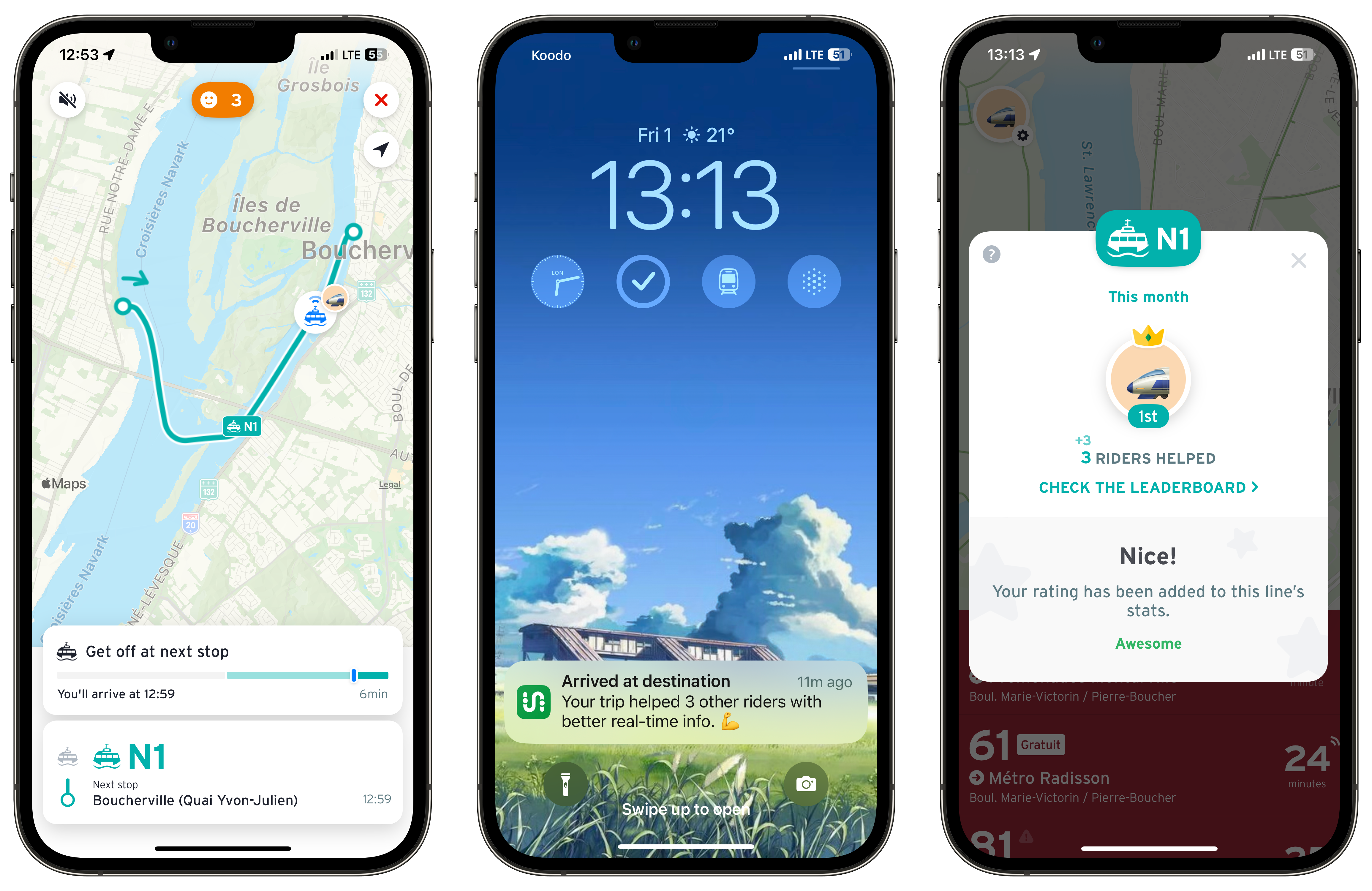
- N1 Montreal Mercier - Boucherville
- N2 Boucherville - Montreal Vieux-Port (the Old Port)
I’ll talk about the experience of riding these two routes in a bit, but first of all I want to look at the network as a whole, and how well it complements and integrates with the rest of Greater Montreal’s sprawling transit networks. After all, on this blog we’re all about connectivity and building networks.
A Network Unto Itself
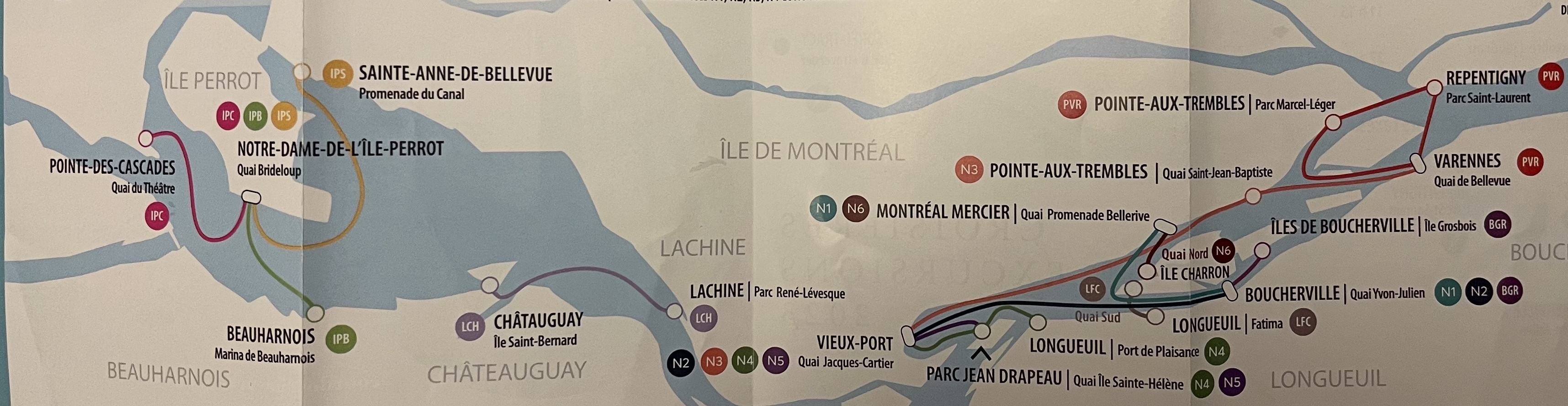
The riverboat network as it stands is focussed on getting riders across the Saint Lawrence river rather than between points on the same shore, as per the Thames Clipper in London.
The connection between the Old Port and Point-Aux-Trembles still exists, but to get further down the river requires changing between services. For example, from the Old Port to Repentigny requires making an interchange at Varennes on the South Shore.
One could argue the riverboat routes aren’t trying to duplicate any existing transit paths. For example, Nun’s Island and Brossard are now more than adequately served by the REM and so a riverboat service would end up being poorly used.
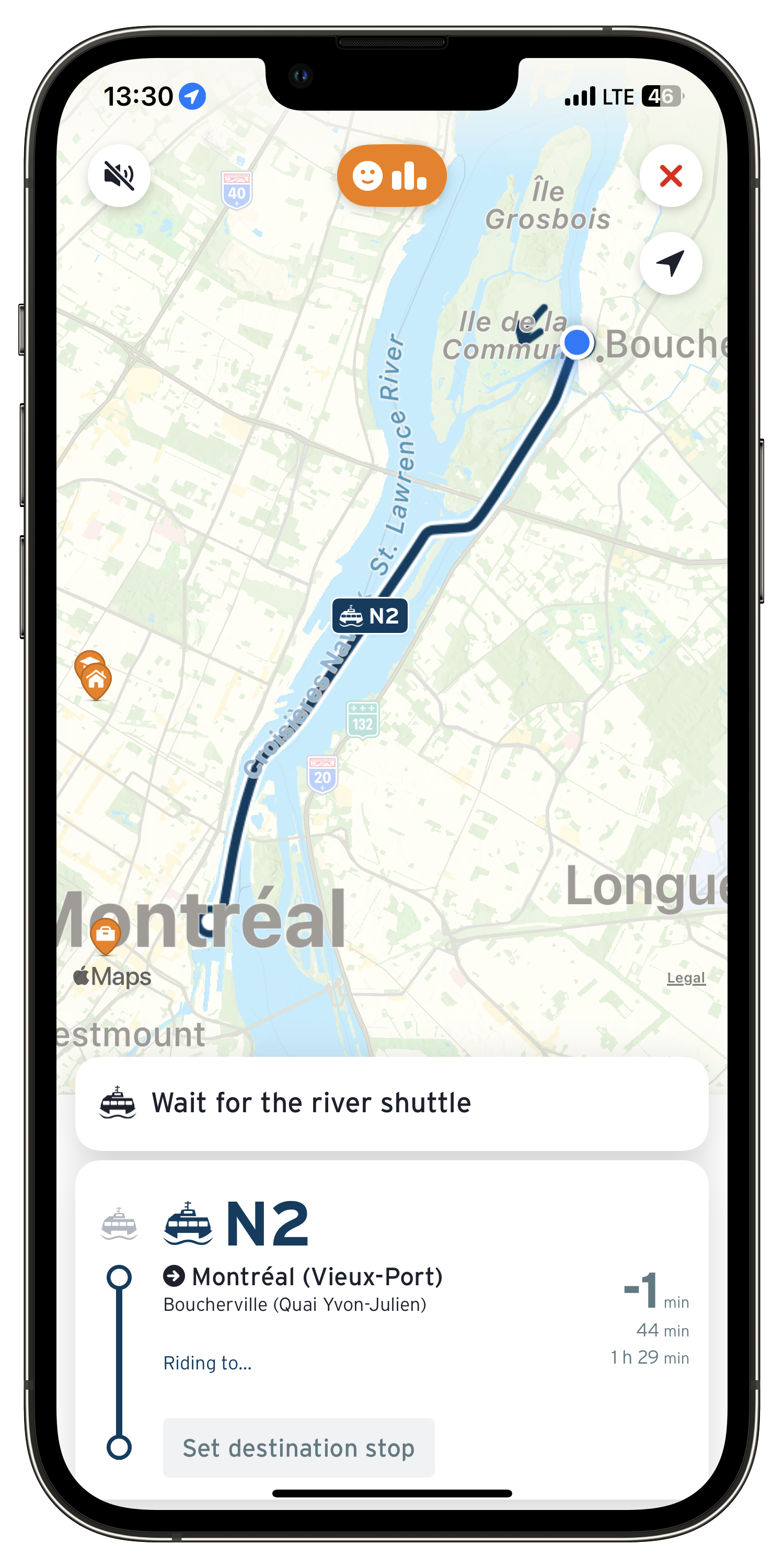
But getting from Downtown Montreal to Boucherville on the South Shore using transit averages at 1 hour 30 minutes and having to change once or twice depending on your route. This contrasts with a 30 minute boat ride with no interchanges which is by far the superior option in terms of speed and comfort, provided you don’t suffer from sea sickness.
It quickly becomes clear that for a specific demographic of commuters in areas traditionally not well served by public transit, boats are a game changer during the warmer months.
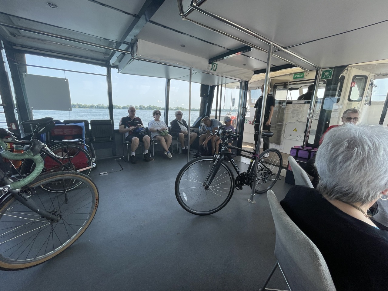
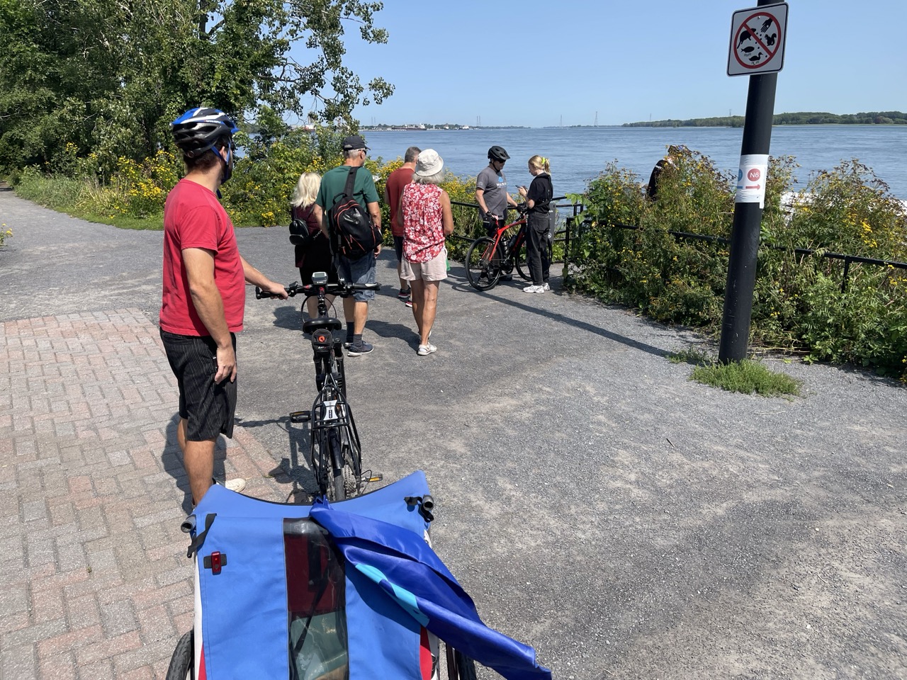
You will however notice some of the routes don’t seem all that useful to commuters, for example N6 from Mercier in Montreal to Ile Charron. That’s because these routes are aimed at leisure travel and provide a way to reach some locations which are close to impossible to reach without driving. Indeed, you’ll find these routes packed with almost as many bicycles as people!
Whilst the bulk of the network focuses on routes along the river between downtown Montreal and Repentigny, there are a few routes out towards the west. One connects Lachine with Châtauguy, another will get you from Saint-Anne-de-Bellevue to Ile-Perrot, and then out to two other destinations remote enough to be problematic to reach by transit.
It’s become a laudable network, filling in for gaps in quick links between points on opposite shores.
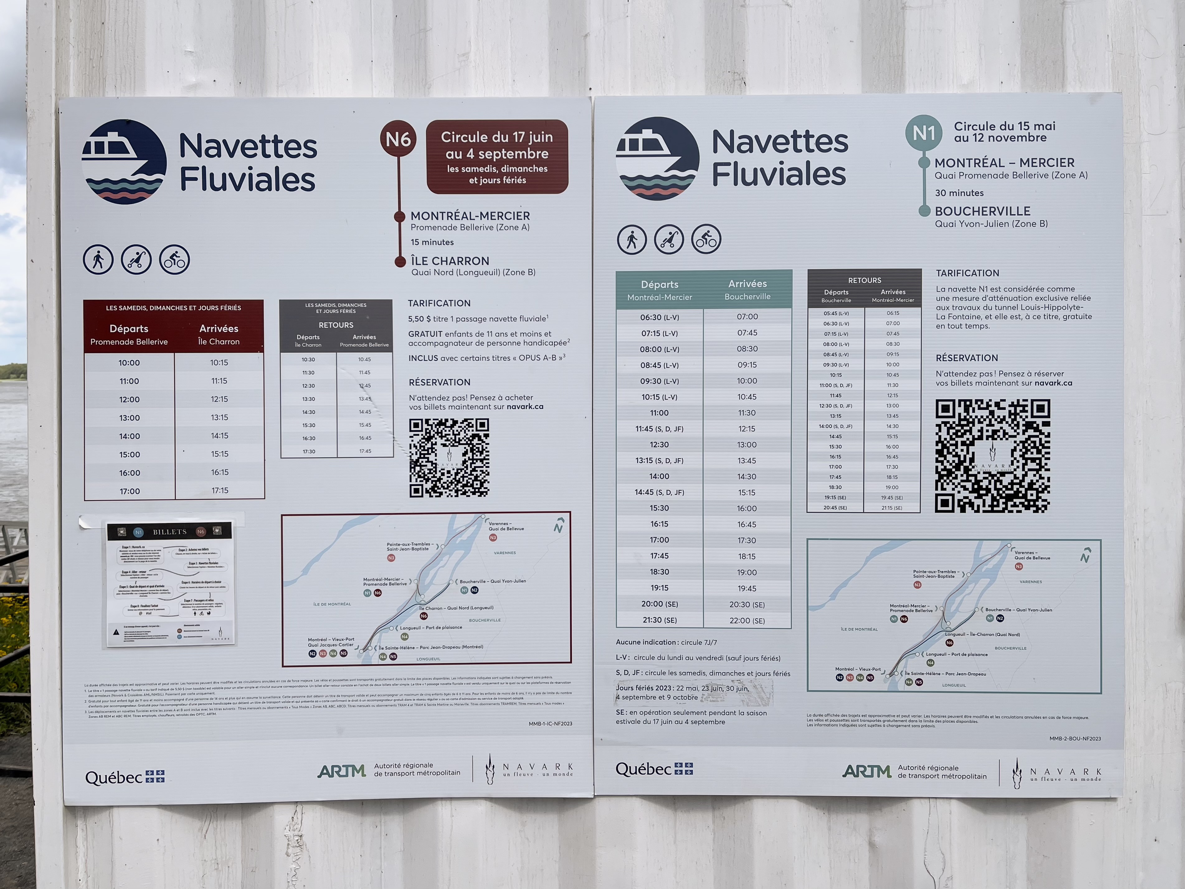
And frequencies aren’t bad at all. The more popular routes run hourly, with others running every 90 minutes or so. It’s not exactly “turn up and go”, but with some basic planning you’ll be able to reach new parts of the region you maybe hadn’t even considered visiting.
I would also expect services to be more reliable than buses, as there’s no congestion on the rivers. The only issue is likely to be inclement weather putting a temporary suspension on services.
Most of the departure points link with some kind of public transit, be it only a single bus route. Obviously geography is at play here, so it’s not going to be possible to have boats connect into the main transit hubs. Even the pier at the Old Port is a good 15 minutes walk from the nearest Metro station. One thing which could be done here to improve things is better timings with bus routes which pass by the various piers, which would require collaboration between separate transit authorities.
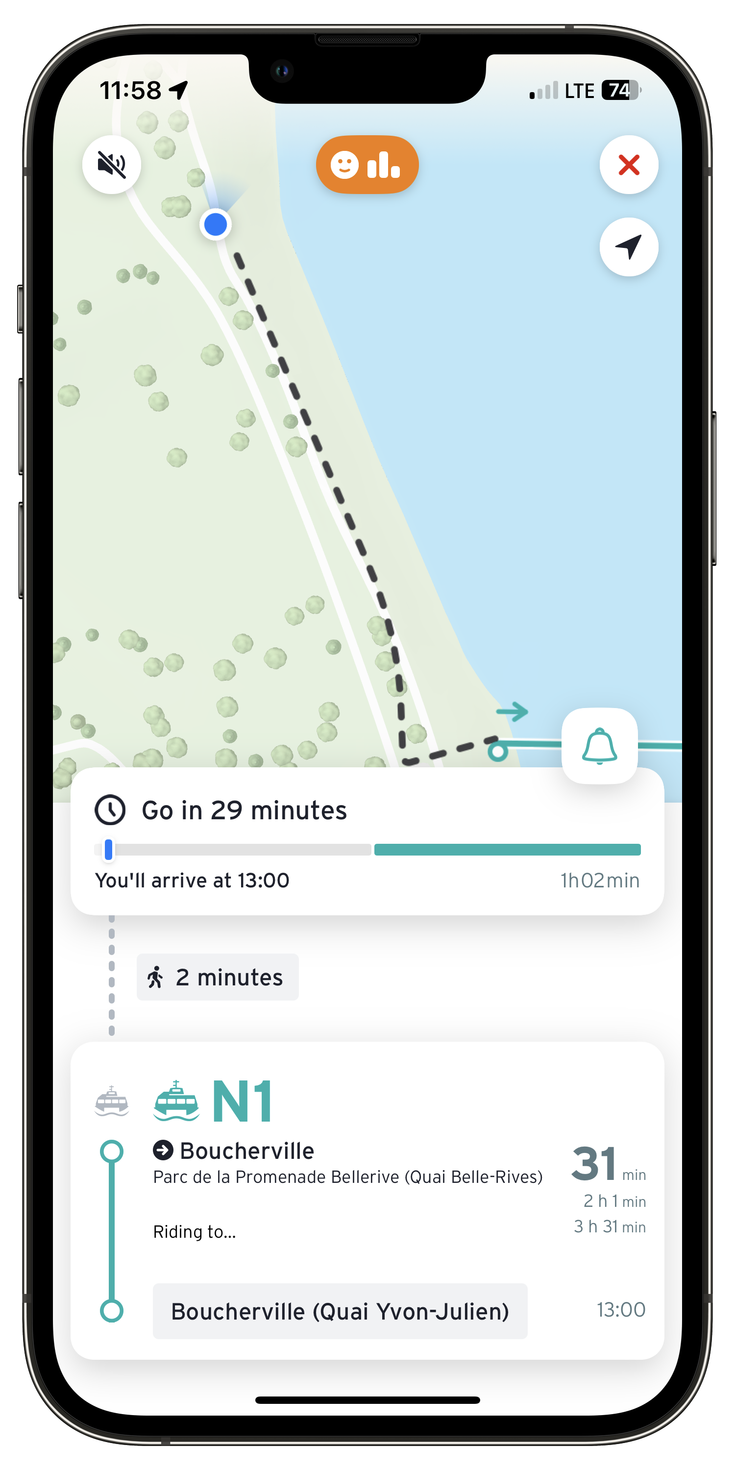
All that said, the boat services are supported by Transit App, so you can plan a complete route between any two places over multiple modes of transit, including the riverboat. You may have to wait around a but for a boat or bus connection, but at least you can have a single integrated travel itinerary.
Raising Awareness
I wrote recently about the new integrated transit map for the Greater Montreal area, and what a difference it makes to people’s perception of transit to see all services on one map, instead of fragmented into different organisations.
There’s a case for adding the river routes to this map. It would be a cartographical challenge for sure, but when we already have lines on the map which aren’t even due to open for years, it’s not a push to make the argument to add river services.
At the very least, the same approach could be taken as with the London Underground map of adding little boat symbols where transit interchanges with the river, although this might be a challenge as in Montreal the piers and Metro stations aren’t really that close to each other. They would necessitate a connecting line showing which bus route(s) to use, and this is where the cartographic challenges come in.
A Circuitous Route
I mentioned before I don’t have a reason to use these boats regularly, but on a hot summer’s day I took a ride to see what the experience is like.
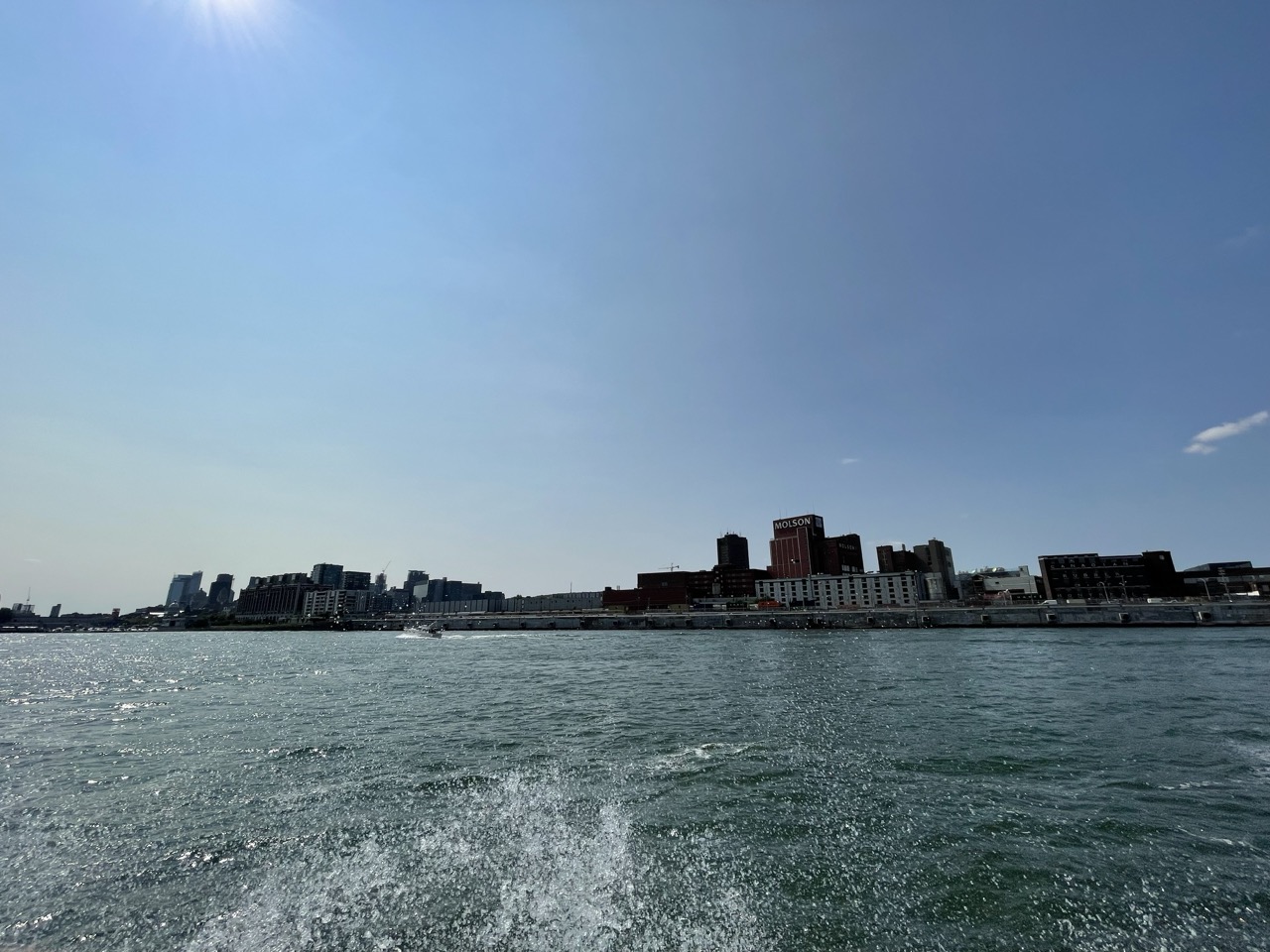
I started out in Promenade Bellerive, a long park which hugs the short in Mercier. The Sherbrooke bus comes right into the park making it quite accessible from a connection with the Green Line at Frontenac. The park itself is delightful with sweeping views over the river and deserves a post of its own, being the closest experience to the “commons” found in London.
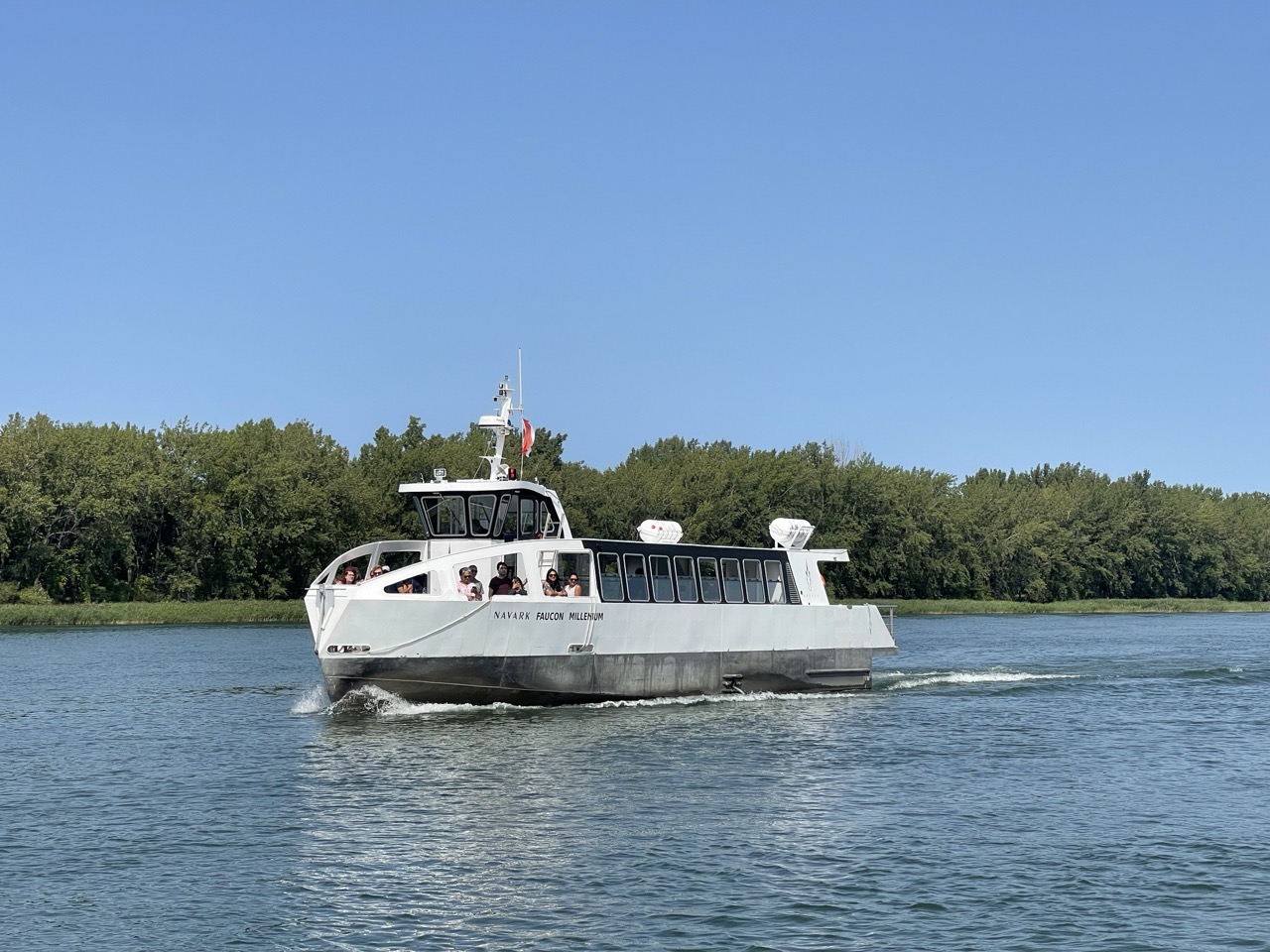
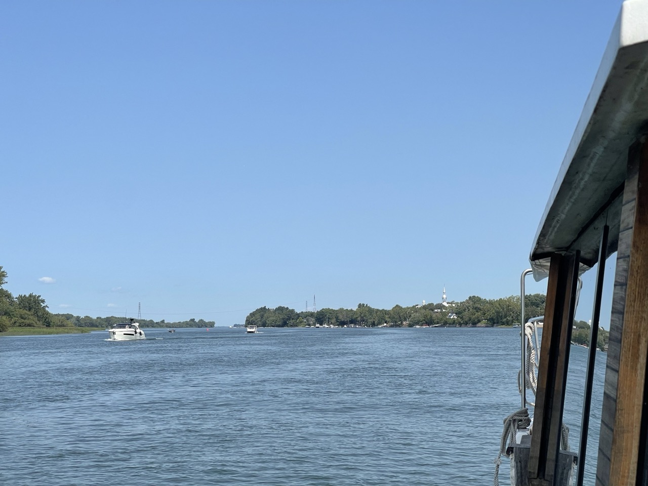
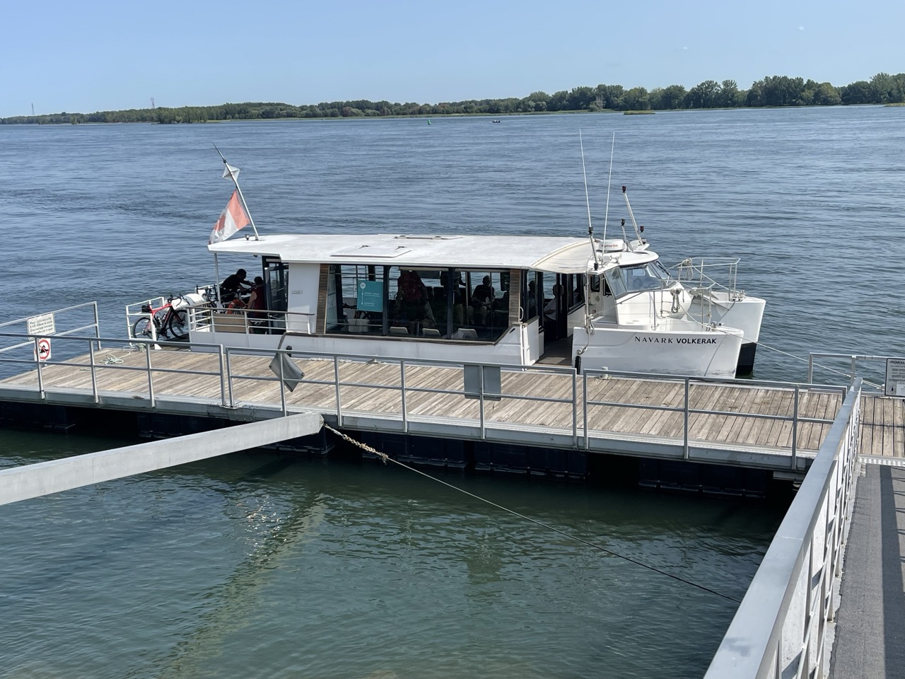
Coming back on topic, we took the N1 boat from Mercier down to Boucherville. From Boucherville we took the N2 to Montreal’s Old Port.
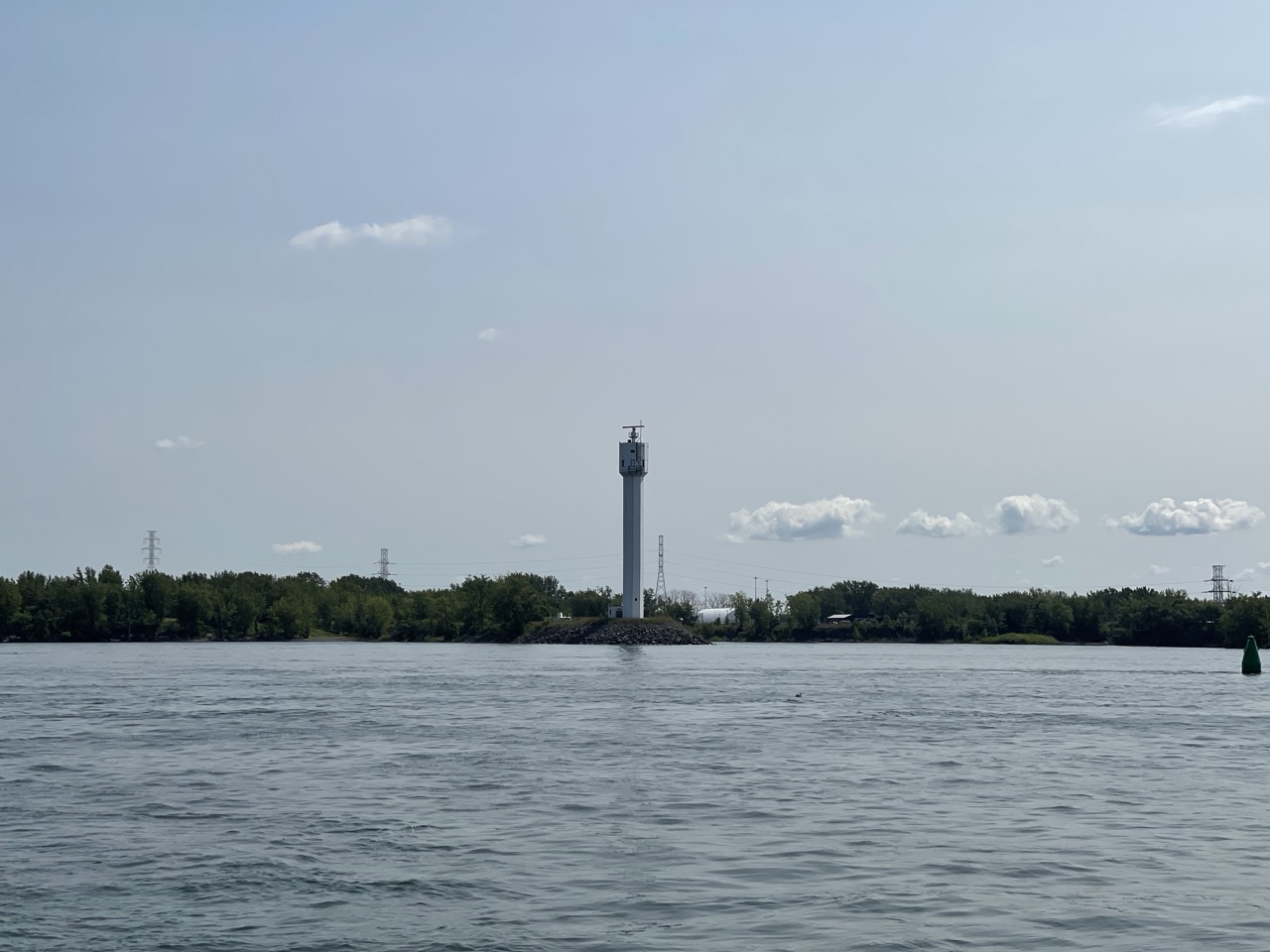
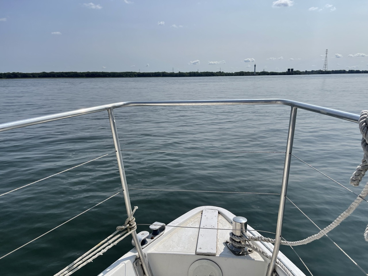
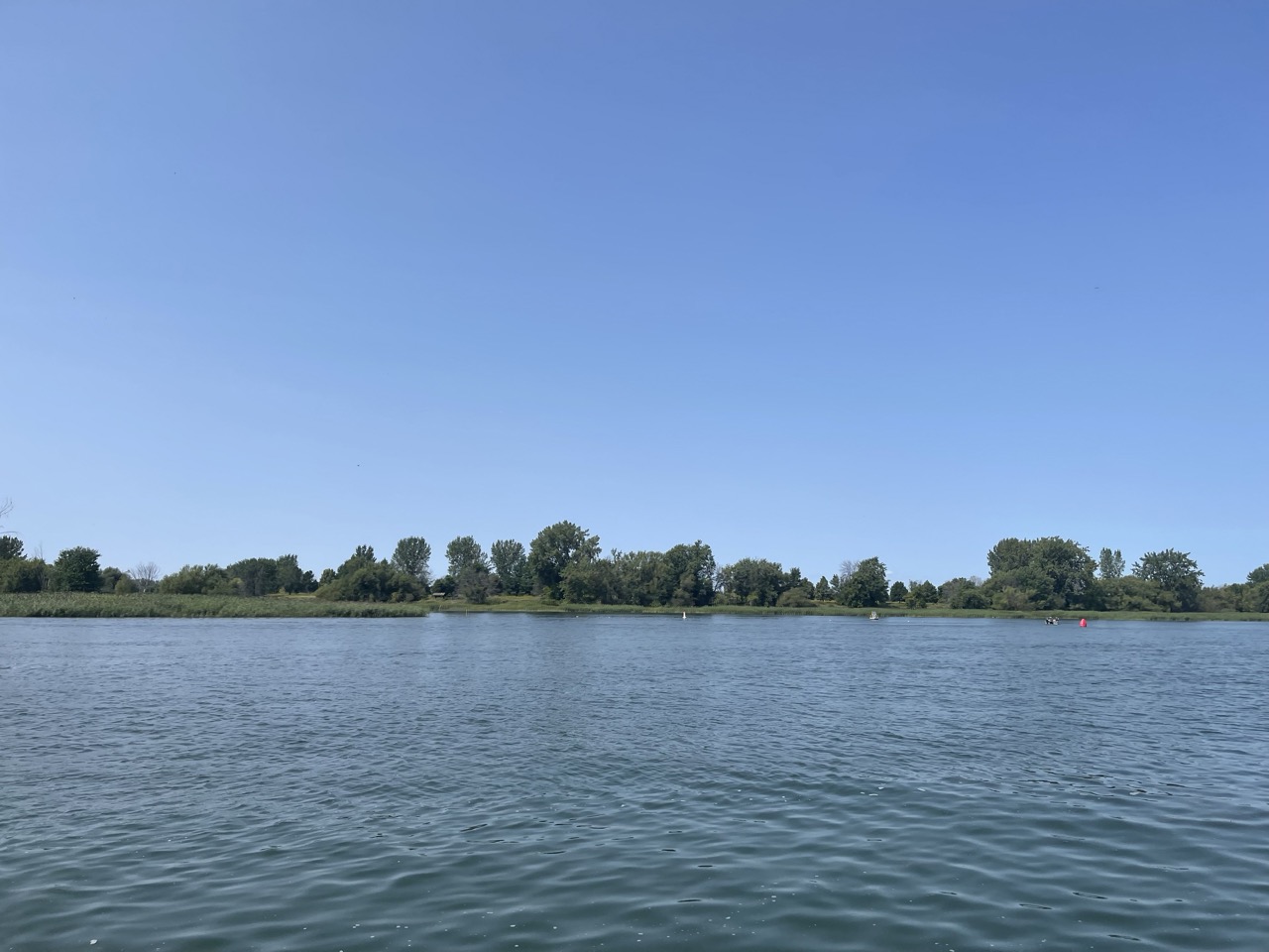
That first boat went at a moderate pace to make the loop around the islands separating Mercier from Boucherville. This route definitely felt like one aimed at leisure rather than commuting due to the short distance covered and the indirect route dictated by geography. But it was a lovely trip going out onto the Saint Lawrence before looping back round along the South Shore.
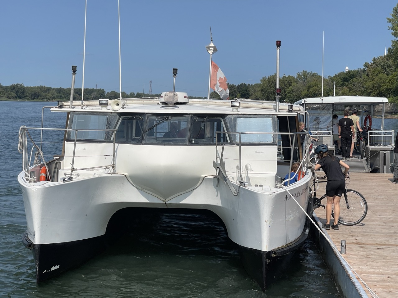
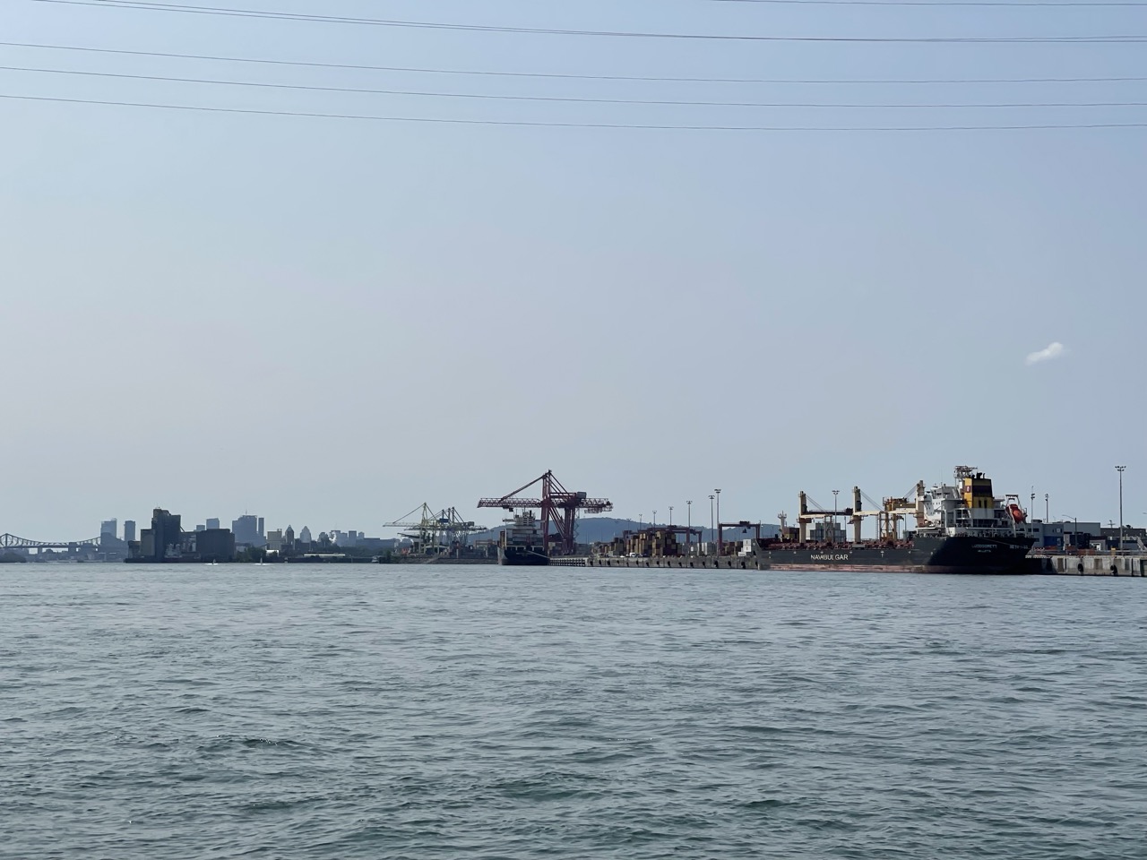
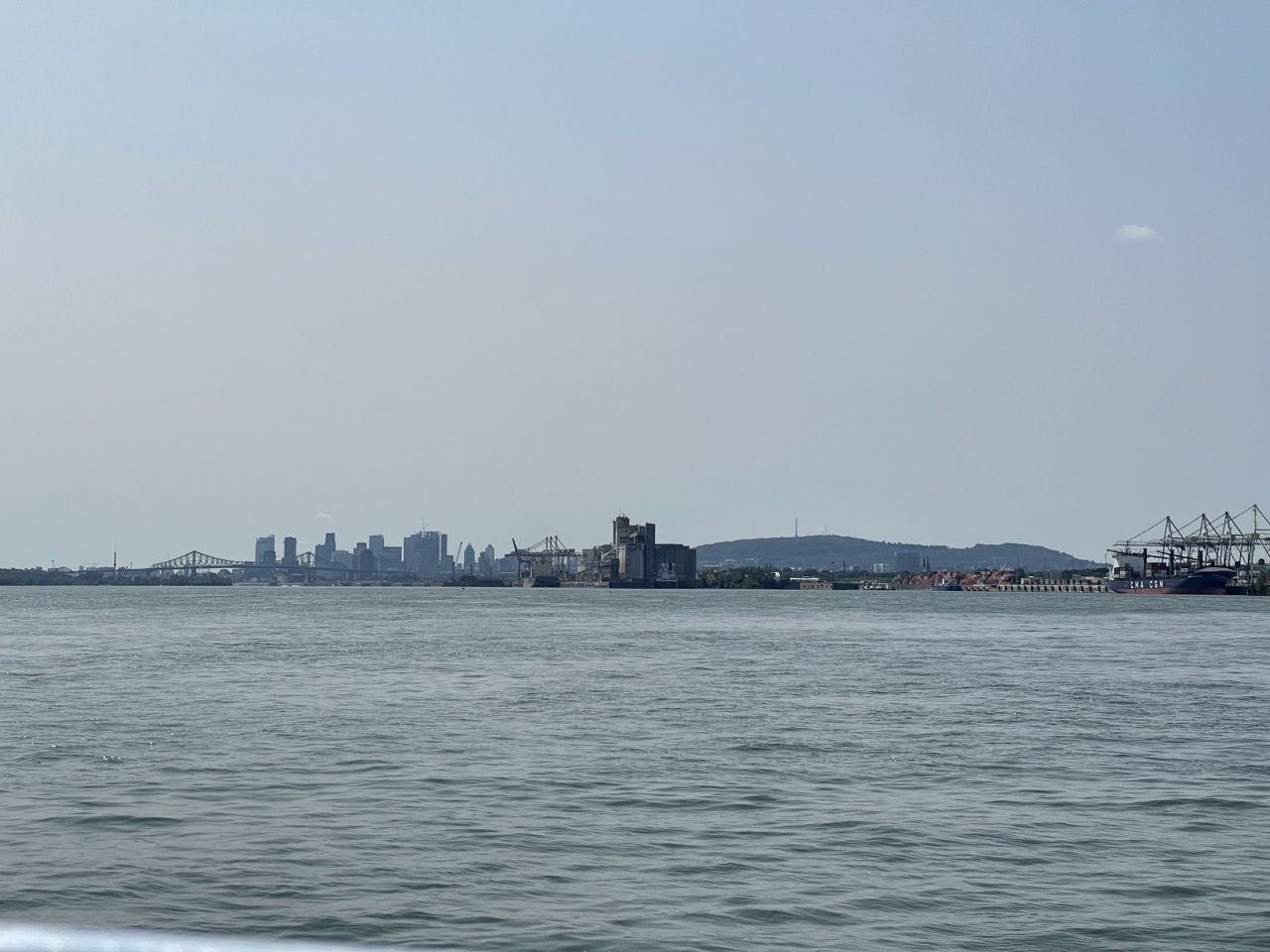
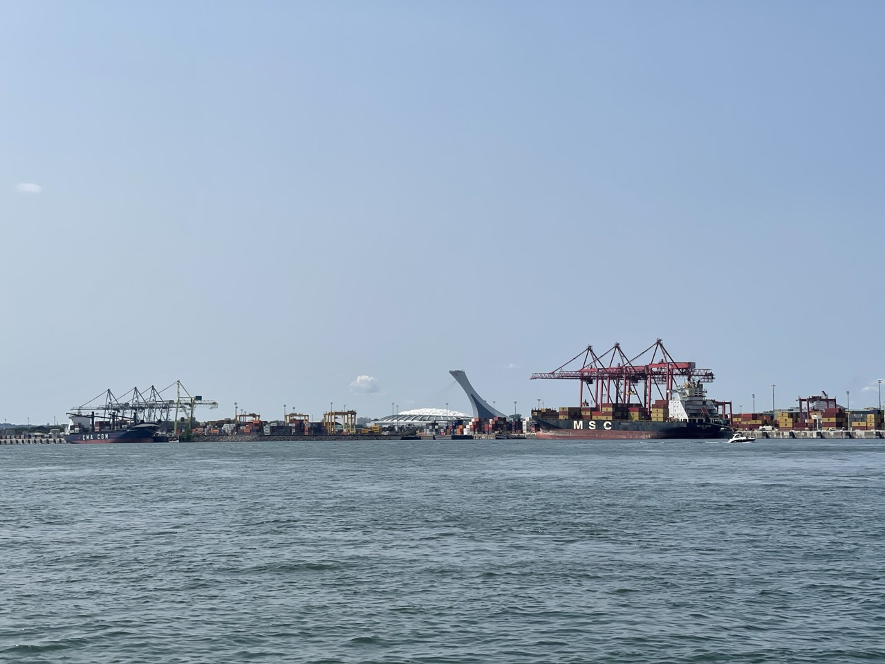
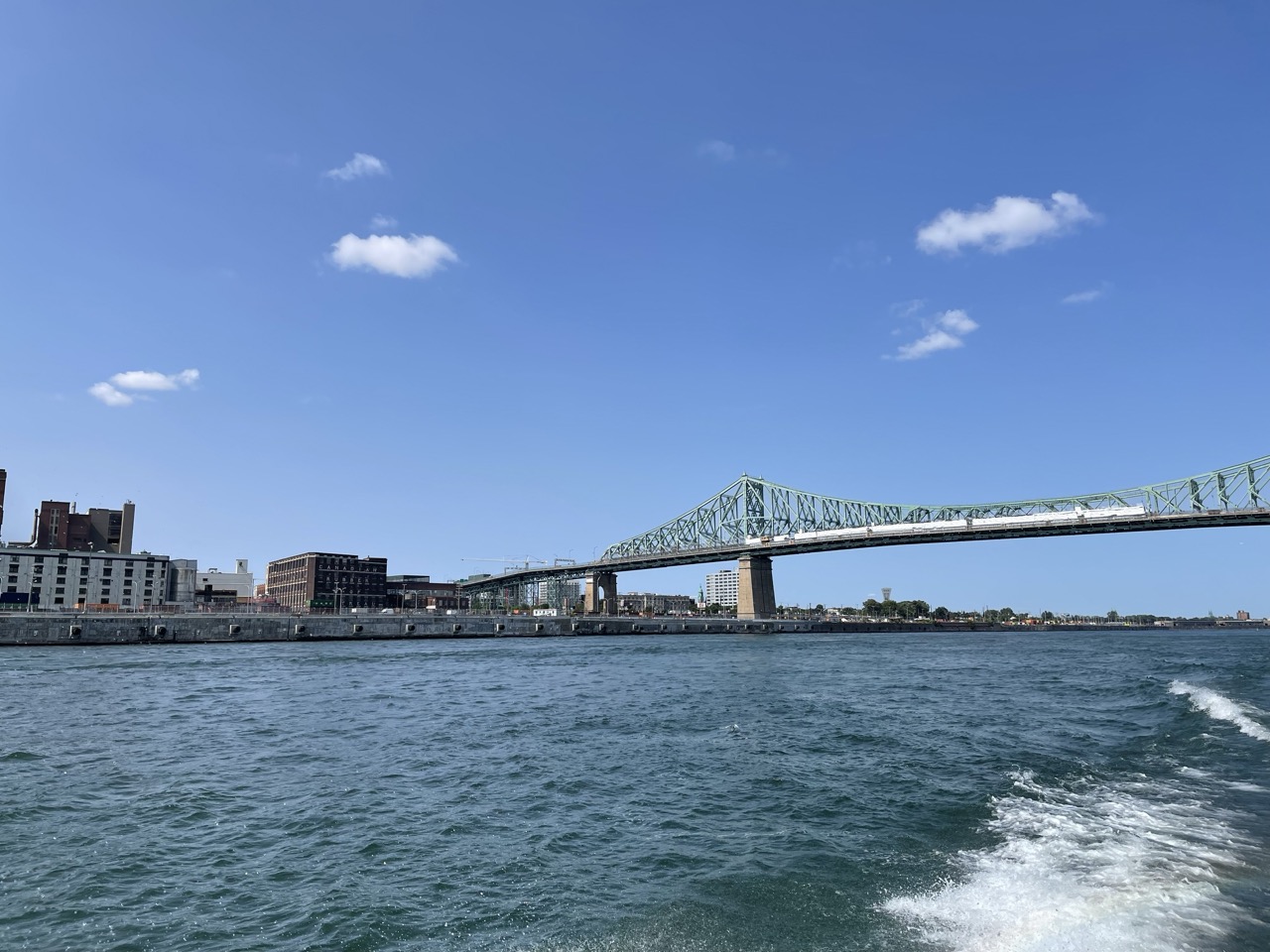
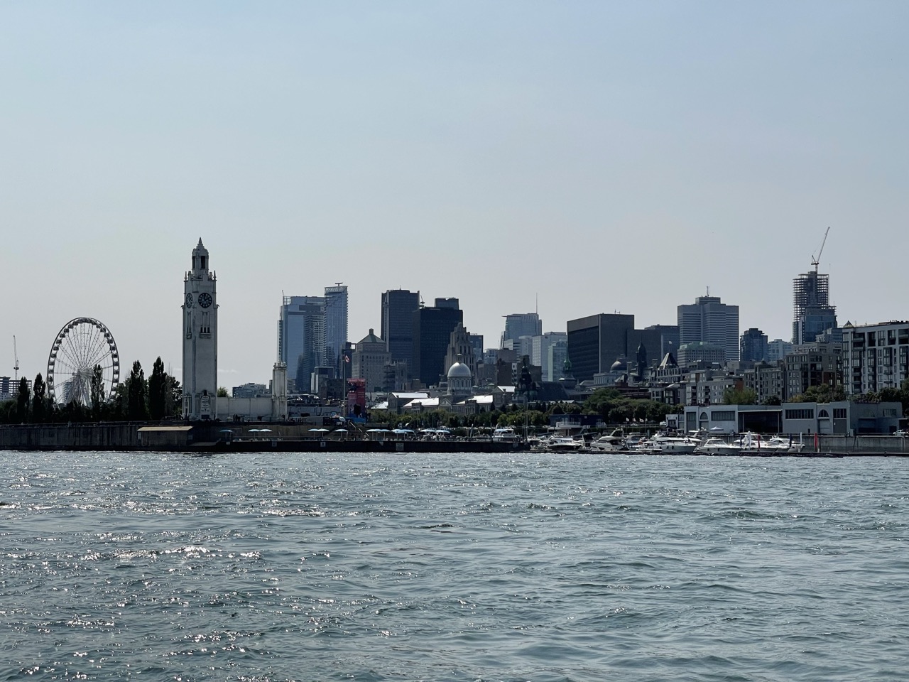
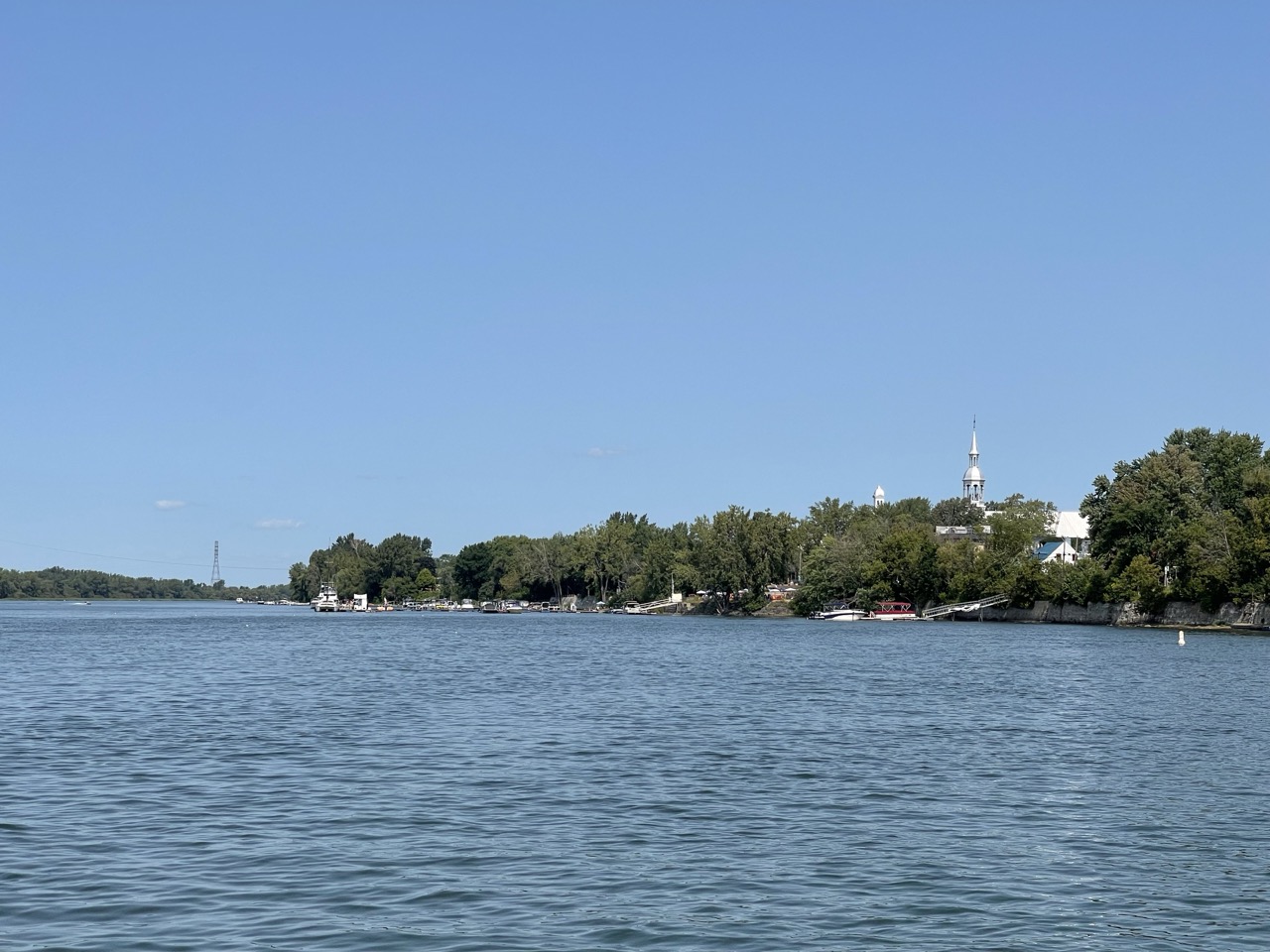
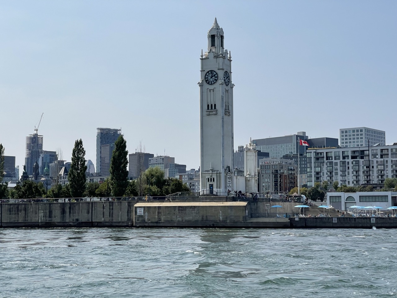
The second trip was the N2 from Boucherville to Montreal’s Old Port. The boat was bigger, faster and lots of space out front to enjoy the excellent views as we approached the city’s impressive skyline along the river. As a commuter this is the fastest way to get between these two points and in more comfort than a bus could ever hope to provide.
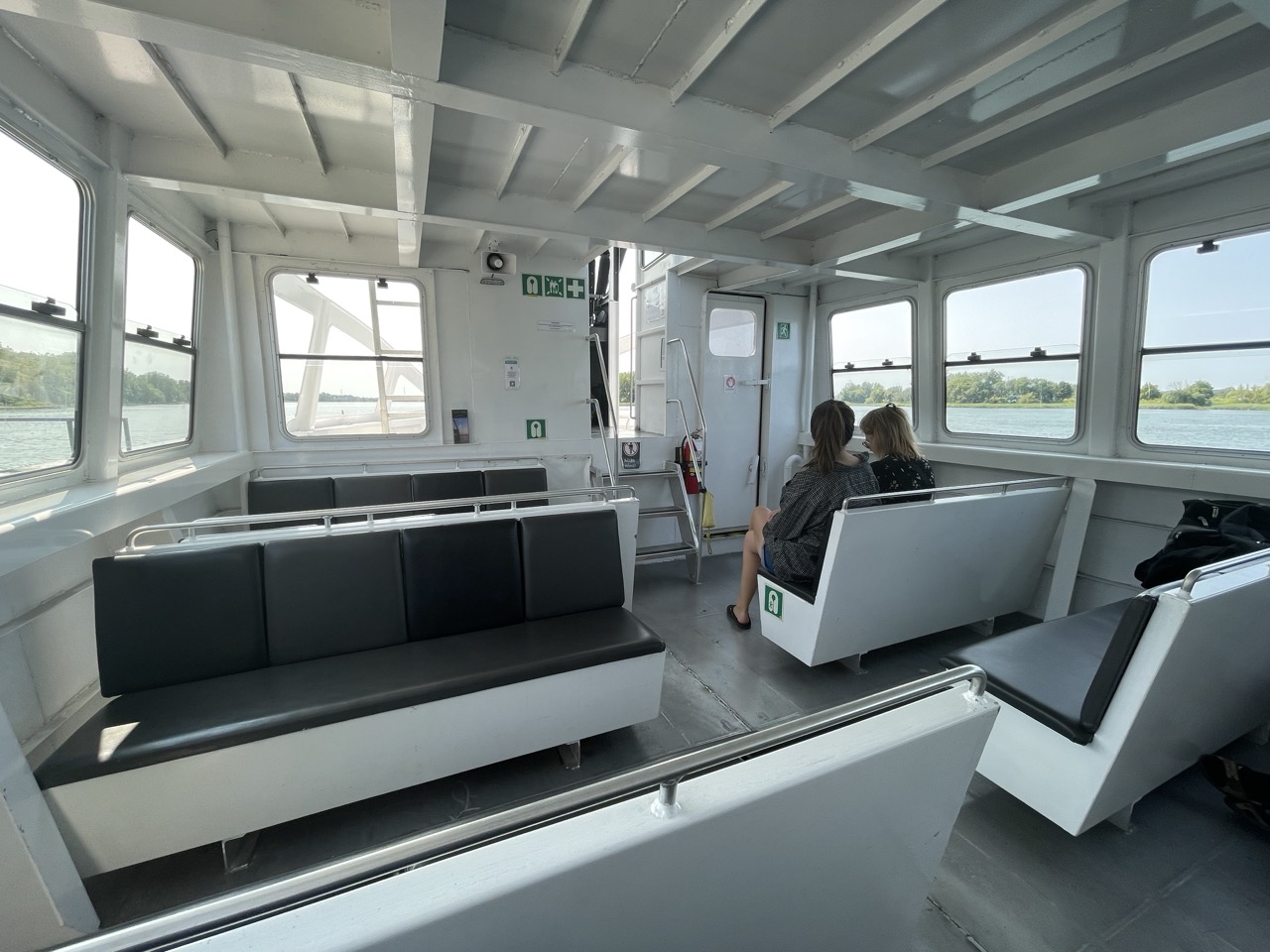
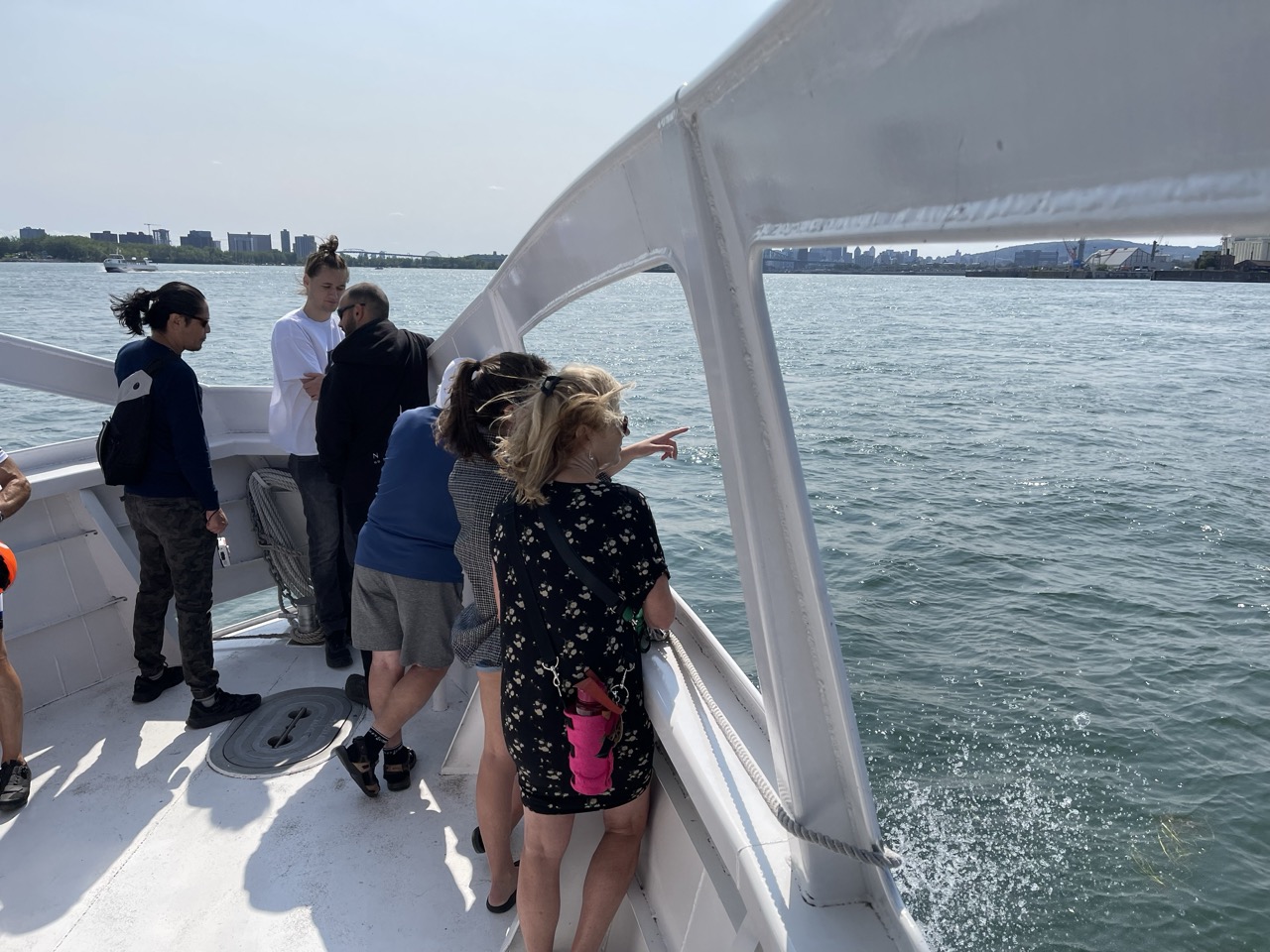
A water jet skier was “buzzing” the boat for a portion of the trip, trying to catch the boat’s wake to perform jumps. He was really annoying the crew as he’d pass quite close and at one point I wondered if he was going to misjudge the pass and collide with the boat, causing an incident.
Fare Integration
To my amazement, the boats are partially integrated with Greater Montreal’s new fare system.
In an ideal world you’d rock up with your day pass and just be able to jump on a boat, but in reality they only accept monthly passes for the appropriate zones.
This means unless you hold a pass for the zones you want to travel through, you need to buy a single ticket, which can be done via the Navark website. Since you need to pick a specific service, it’s best to do this once you’re physically at the pier in case you miss your connection.
The purchase process works pretty well on an iPhone, and results in a QR code which will be scanned as you join the boarding queue. It was critical Navark got the online payment process right in order to make the service accessible, and they nailed it.
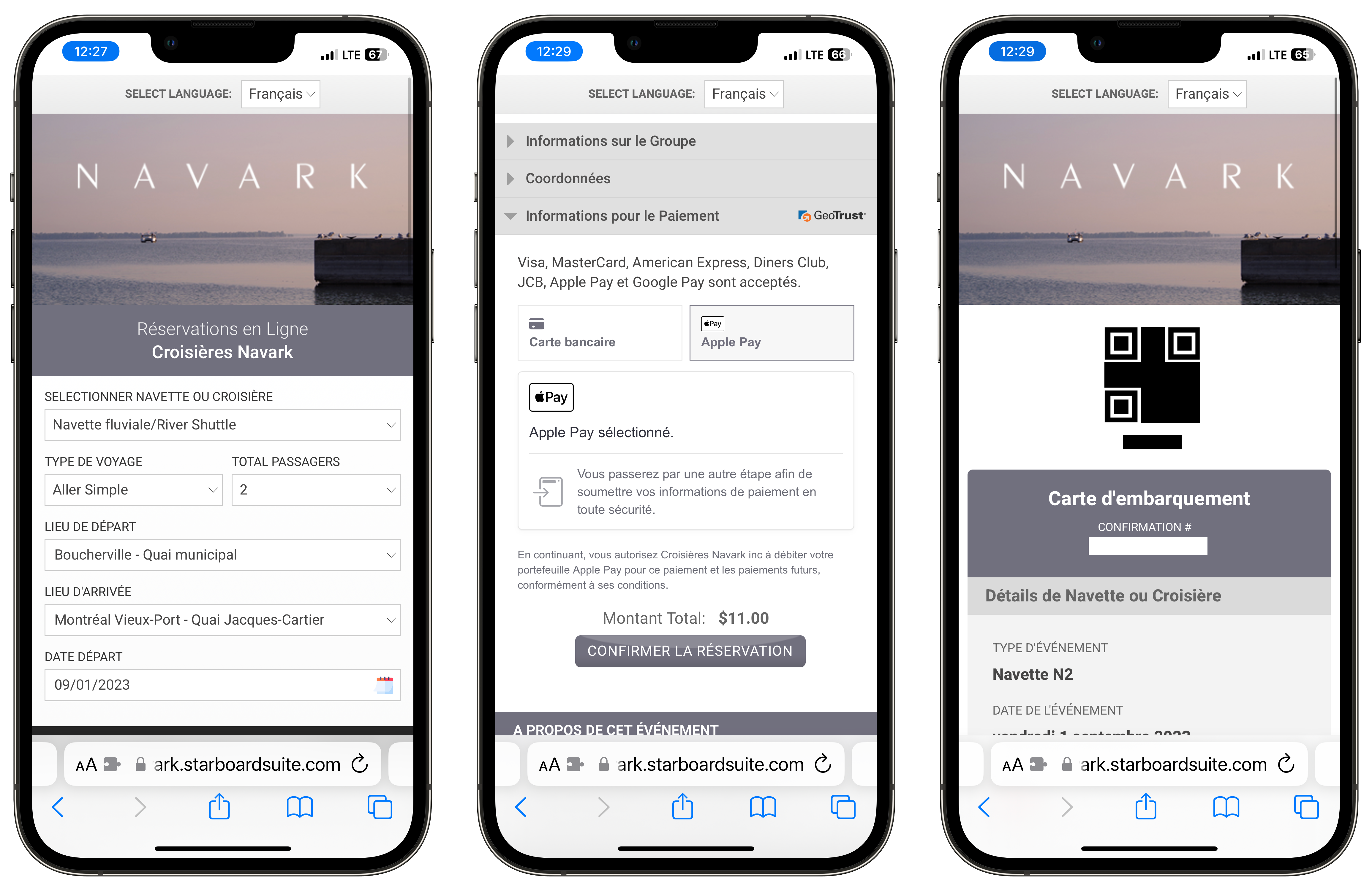
If you want to buy a ticket in the traditional way, this only seems possible at the larger piers – such as the Old Port – where there’s a dedicated ticket booth. There didn’t seem to be a way to buy a ticket as you board the boat at Mercier, and it seems they let a couple of people on free of charge rather than leave them stranded. This is an unfortunate oversight, as whilst most users of the service will have a phone and be comfortable navigating payment websites, it does overlook the travellers who may prefer or need to use more traditional means to purchase their tickets.
Final Thoughts
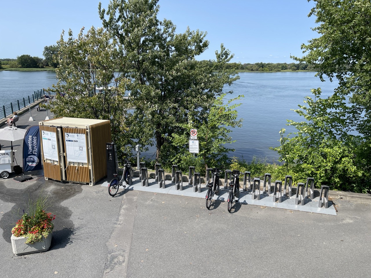
I had a very brief encounter with the riverboat service, but it’s looking pretty good indeed. If I had the boat as an option for my commute I’d jump at the chance to use it, especially as a monthly travel pass covers its use. I’d probably supplement the final mile with Bixi, which is not only available downtown but even at some of the outlying riverboat piers such as Boucherville.
I really hope the service goes from strength to strength over the coming years. It would benefit from deeper integration with the rest of the region’s transit, be that minor modifications to bus routes or inclusion on transit maps.
The ARTM also needs to publicise the service more than they have, to get it on people’s radars as an alternative means to get from the suburbs to downtown.
I wasn’t expecting the boats to be as positive an experience as they were, and I’m already thinking ahead to next summer and all the new places I might explore. I’m looking forward to connecting more with Montreal’s maritime heritage, something which us island-lubbers often overlook.
The boats join the Metro, REM, trains, BRT, buses and Bixi in making Montreal an ever more impressive transit city.
Edit 29/12/23: Updated text to note Repentigny is down river rather than up. Also thanks to Mike for letting me know the radar tower is aviation related.